 Catalogue PIGMA
multi-beam echosounders
Type of resources
Available actions
Topics
Keywords
Contact for the resource
Provided by
Years
Formats
Representation types
Scale
Resolution
-
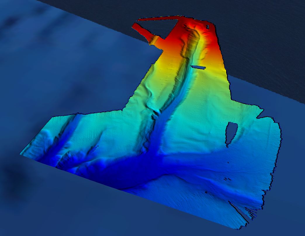
Conversion into the EMODnet format of the published grid for the Capbreton Canyon in 2007: http://dx.doi.org/10.12770/72e2f750-c255-11df-a9b6-005056987263
-
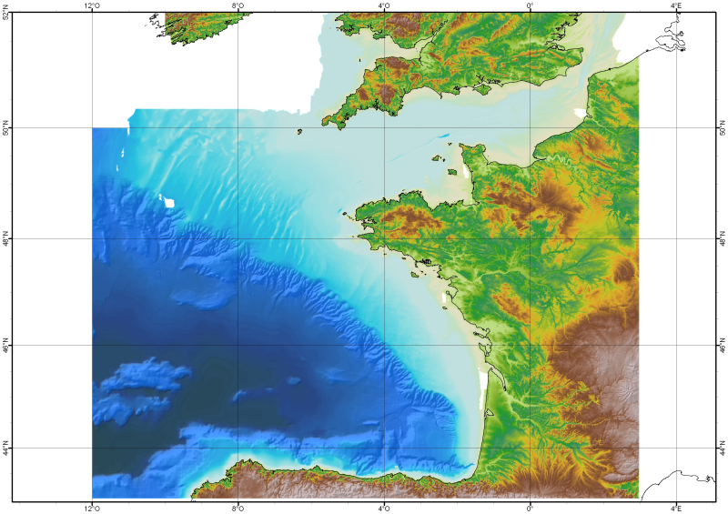
The Digital Terrain Model of the Bay of Biscaye and of the Channel is the result of the processing of a compilation of single and multibeam echosounder data, of DTMs and of chart countours produced before 2008 for hydrodynamic modeling..
-

The Digital Terrain Model of the Bay of Biscaye and of the Channel is the result of the processing of a compilation of single and multibeam echosounder data, of DTMs and of chart countours produced before 2008 for hydrodynamic modeling.
-
Grid processed for the purpose of the HR DTMs layer of EMODnet Bathymetry HRSM, October 2018
-
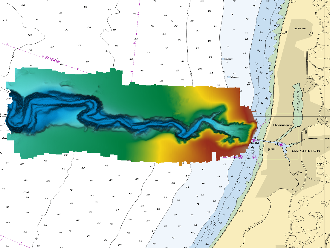
The DTM is a compilation of multibeam echosounder surveys acquired in 2013. The resolution is 1/64 arc-minutes (~30m). Surveys are located on the Capbreton Submarine Canyon (France) with depths from -4.7m to -344.9m. Depths are referenced to the Lowest Astronomical Tide and the coordinates are expressed into the WGS84 reference frame. The surveys which compose the DTM are S201306500-09 and S201306500-11. Data and metadata associated to these surveys are available on the website http://diffusion.shom.fr/pro/lots-bathy.html. The DTM is not to be used for navigation.
-

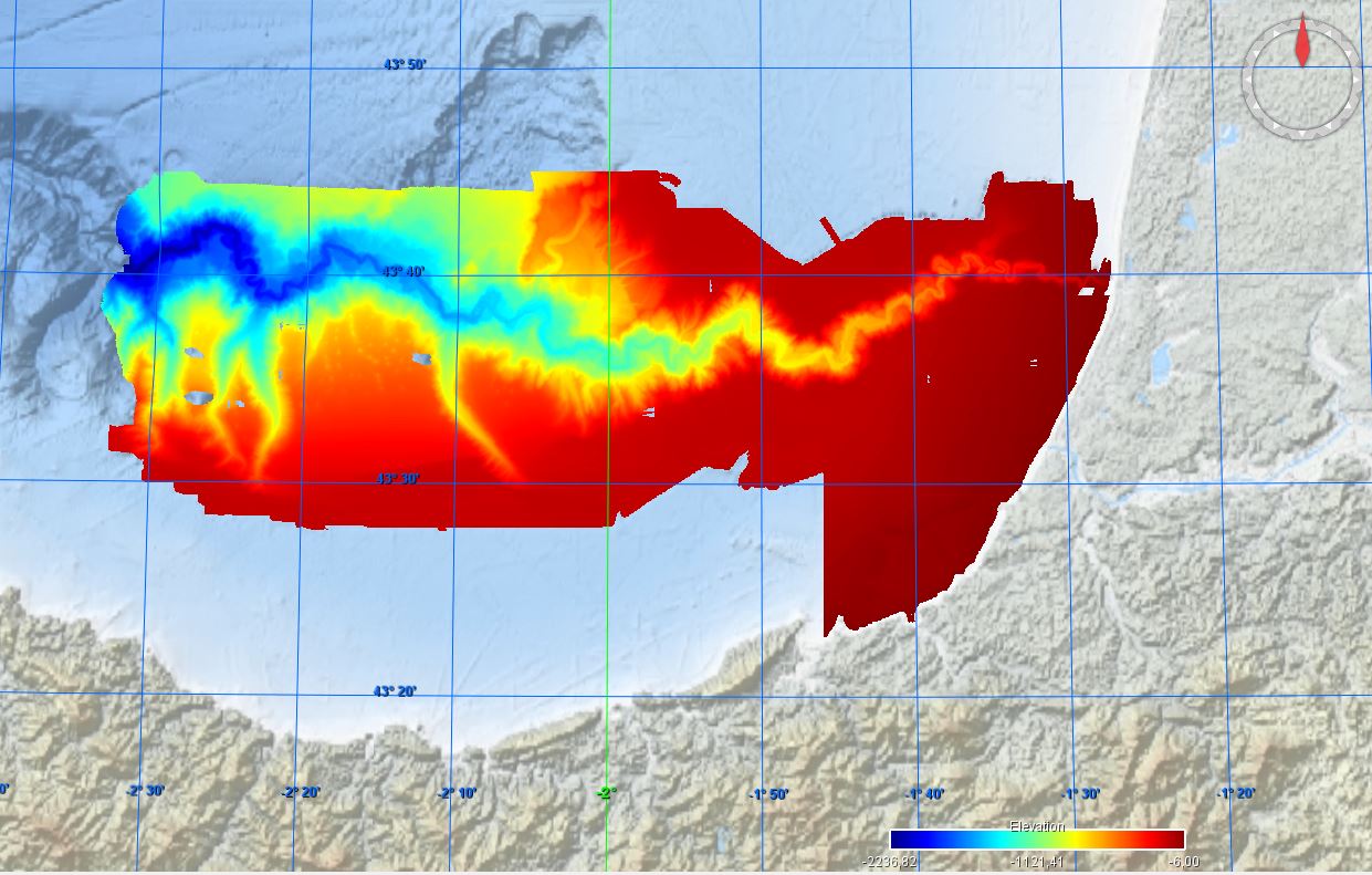
DTM of continental margin of Cantabric Sea, resolution 100 meters. This DTM includes the whole area from coast line to deepest level (5544,23 m).
-
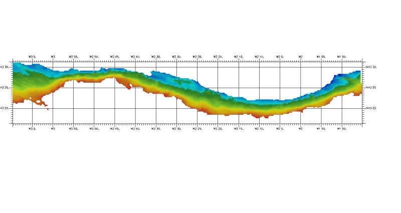
DTM of coast of Biscay and Guipuzcoa , approximately 250 m resolution. This DTM includes the whole area from coast line to deepest level (144,058 m)
-
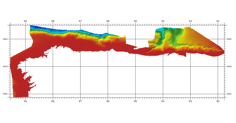
DTM of continental margin of Cantabric Sea, approximately 200 m resolution. This DTM includes the whole area from coast line to deepest level (5216,74 m).